Barbary Castle on Marlborough Downs
A change of venue from previously adertised due to pheasants and overgrown paths.
So we make a welcome return to Barbary Castle, but alas, not to the farm café which suffered a fire (nothing to do with The Pack). Walk leaders are Guy and Sarah Bridge. Any problems please email them here.
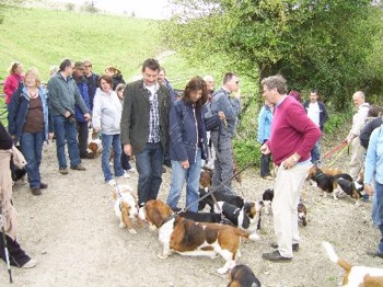
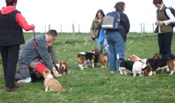
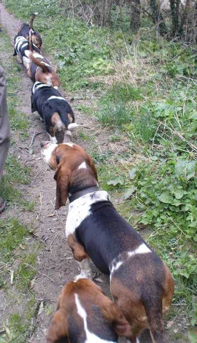
The photos are of our last walk here in April 2009.
As the guide book says "Barbary Castle, near Marlborough, was built
by the Celts in the sixth century. Constructed
in a double-earth bank design, the outer bank
was reinforced with huge Sarsen Stones that
can still be seen today. Barbury castle offers
great views north of the Marlborough Downs
towards Swindon and can be a good spot to
watch the sunrise as the mist clears" (Not sure about the last bit, but never mind).
To reach the start (10.30am)
From Junction 15 of M4:
Take B346 south (signposted to Marlborough).
At top of rise take right hand turn onto B4005 (signposted Chiseldon & Wroughton) - NOTE the turning is immediately before a petrol station.
Continue into Chiseldon and turn right at mini roundabout by 'Patriots Arms' Pub following B4005.
Continue along B4005 (about 1.5 miles) until you reach a 'T' junction where you turn left (there is a brown tourist sign to 'Barbury Castle').
Follow this road for about a mile – the road narrows to single track with passing spaces after a new housing estate on your right.
At the top of the hill (known locally as Brimble Hill) the car park is to your right.
An alternative route from the South West to avoid M5/M4 is to follow A303 to Amesbury, turning onto A345. Follow the A345 to Marlborough. Join A346 towards M4/ Swindon. After about 10 miles you will see the petrol station on left – this is the junction to turn onto B4005. Follow directions above.
Note: Google maps show an alternative route from Marlborough (Frees Lane) – do not take this route as the last mile or so is very badly damaged by 'off roaders' and is not passable in a normal passenger car. However it might be helpful to use Google maps by tapping in the postcode, SN4 0QH.
Notes on walk:
- A lot of the walk, whilst on a 'National Trail' and along Public Bridleway, is through farmland and it may be necessary to put hounds onto leads in certain fields/ areas as a livestock precaution.
- The first half of the walk is along 'The Ridgeway Path' which as the name suggests is along the ridge of the hills through open Down land – it is usually breezy so carrying a 'windproof' is recommended.
- Bring plenty of water for the hounds.

|